• Skip to primary navigation
  • Skip to main content
  • Texas A&M Forest Service
  • Texas A&M Veterinary Medical Diagnostics Laboratory
  • Texas A&M AgriLife Extension Service
  • Texas A&M AgriLife Research
  • Texas A&M College of Agrculture and Life Sciences
Working on Wellness Environments
Working on Wellness Environments (WOW-E) is a Texas A&M AgriLife Extension multidisciplinary community development program
  • Menu
  • Home
  • About
    • What is WOW-E
    • Meet the Team
    • Our PSE Approach
    • The HOP Program
    • WOW-E Counties
  • Stories
    • Blog
    • Videos
    • WOW-E Photo Walks
    • Success Stories
  • Resources
  • Projects
  • Technical Assistance
    • WOW-E Technical Assistance Process
    • WOW-E FY 2026 Technical Assistance Cycle
  • Become a WOW-E Community

Celebrate Your Local Parks and Places!

September 20, 2023 by Kailey

By: Valeria Jauregui

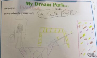
How many active parks and places do you think there are in Rio Grande City? Did you know there are at least 17? Did you know the city of Roma has at least three? Parks, schools, plazas and paths can provide most people with a place to be active and spend time with family and friends.

Many people do not know about all the parks in their communities—even in smaller communities. According to Jamie Rae Walker, Ph.D., Texas A&M AgriLife Extension associate professor and urban and municipal park specialist, research says lack of knowledge is one of the barriers people report for why they don’t visit their local parks and active places.

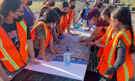
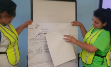
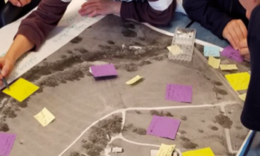
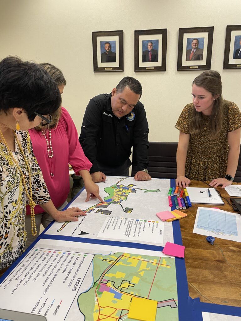
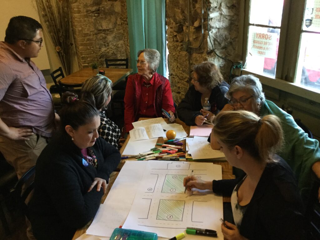
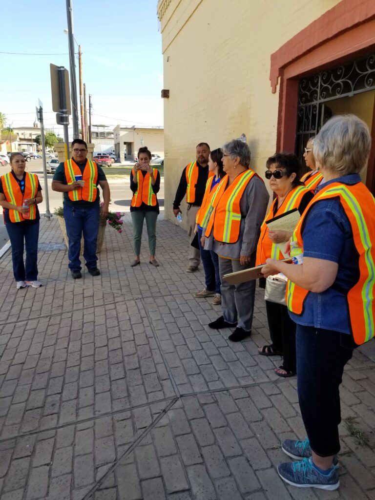
Roma, Rio Grande City, and the city of Eagle Pass are working with Texas A&M AgriLife Extension’s Working on Wellness Environments (WOW-E) program to tie into the CDC’s Active People Healthy Nation (APHN) campaign. This campaign aims to get 27 million more Americans physically active by 2027. The goal of these local efforts is to make residents “in the know” about parks and active places so more can visit and use them to be active, socialize, and enjoy time outdoors.

The campaign is in full swing; here’s what community members have said about it:

“[The billboard] is going to make people think, ‘I want to go find [the parks!]”

“It’s a great source of information and inspiration because people will want to go and find [the parks] and use them.”

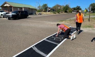
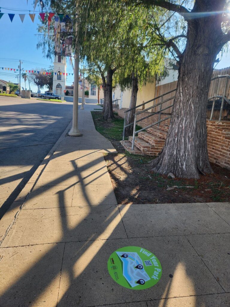
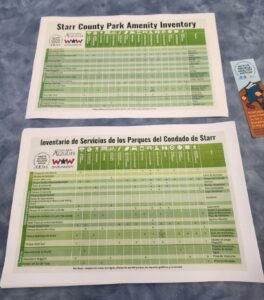
Residents of Roma, Rio Grande City, and Eagle Pass can visit tx.ag/parks to learn about parks and other active places like plazas, walking trails, bike lanes, and schools with after-school amenities. The website also includes information about StoryWalk™, a program that allows children and families to get active together while they read a book that is posted page-by-page along a designated route.

Watch your community for more resources, like billboards, maps, posters, and cues around to help you learn about local active infrastructure. For more information, visit tx.ag/parks.

Note: Texas A&M AgriLife Extension’s Working on Wellness Environments (WOW-E) program is funded in part by the Centers for Disease Control (CDC) High Obesity Program.

Filed Under: Blog Tagged With: Active People Healthy Nation, Agrilife Extension, parks, wowe

Embracing Youth Perspectives for Community Change

July 26, 2023 by Kailey

By Anna Stehling

When planning for community change and improvement, it’s easy to overlook a segment of the population that is often underrepresented among community planners and professionals: youth.

Those under 25 have a unique experience and perspective in their community and often aren’t scared to speak the truth about what they see. If you want to make a change in your community that is impactful, meaningful, relevant, and sustainable, engage the community, including the youth.

FACES OF OUR PAST, PRESENT, AND FUTURE

Changemakers around the world tap into younger generations for their outlook and input. For example, as Kailash Satyarthi campaigned against child labor in India, he made sure to include the children and youth impacted by these situations. For the social reforms he helped bring about, he was co-recipient of the Nobel Peace Prize, along with Malala Yousafzai, in 20141.

His perspective is captured here: “The power of youth is the common wealth for the entire world. The faces of young people are the faces of our past, our present, and our future. No segment in the society can match with the power, idealism, enthusiasm, and courage of the young people.2”

As you look to make a difference in your community, whether large or small, embracing the power of youth perspective can shape your outcomes in positive ways.

MEANINGFUL PERSPECTIVES

Youth participation and engagement are important to a meaningful planning process for myriad reasons. Not only are young people the future of the community, but they are here right now, and their opinions matter. Regardless of age, all people have experiences and opinions that are valid. Youth community members have a right to be included in decisions that will affect them.

Bringing youth to the table and giving them a voice and an opportunity to contribute to change also can foster a sense of ownership and belonging. Young people that are involved in their community change will likely feel a sense of investment in their community and will develop a sense of ownership and pride there as well.

Young people experience and view their community in a way that is unique, which makes them a significant group to tap into. Community leaders should capitalize on the fact that youth have a one-of-a-kind lens through which they view their surroundings.

OBSTACLES TO OVERCOME

Why don’t we embrace the power of the youth perspective more often? Perhaps it’s that community leaders look to professional peers, who are often older. It also takes a concerted effort to engage young people and figure out where to find them. There also might be preconceived ideas about what they care about and how involved they want to be. Keep an open mind–you will probably be surprised.

CONNECTING WITH YOUTH

It can help if you understand a few things about the younger generations by talking to them. Here are some ideas for getting in touch:

· Reach out to current contacts about the young people in their lives.

· Connect with local high school guidance counselors and ask for their recommendations about how to interest students in your goals.

· Utilize social media to reach younger generations (Instagram is a good start).

· Put up flyers at the places where youth gather, like libraries and community sports venues.

Once you have a handful of young people interested, let them plan a fun event and invite their friends. Pizza, anyone?

PLAN TO SUCCEED

Aiming to increase youth engagement and participation can be woven into your efforts as you work to change your community. Participation might start off small, but incorporating youth in your efforts will likely strengthen it for the future. Think long-term, make use of your connections, and stay optimistic: Your community, young and old, will benefit.


Sources

1 https://en.wikipedia.org/wiki/Kailash_Satyarthi

2 https://www.forbesindia.com/article/thoughts/thoughts-on-being-young/66673/1

Filed Under: Blog Tagged With: Agrilife Extension, blog, wowe, Youth

Planning to Plan? Here’s Where to Start. 

May 3, 2023 by Kailey

By Emily Gunderson  

Planning is an essential part of any successful endeavor, whether it’s launching a new project or implementing changes within a local, county, or state government. By planning effectively, you can assure the best use of available resources and your fit within larger governmental planning processes. However, before you jump into planning, it’s important to consider the factors that influence change and understand how to work within the already-established framework. 

Knowing that change often occurs through smaller-scale efforts that accumulate to larger movements is essential. You may not see immediate change, but by implementing small changes, you can contribute to a broader change over time. Consider the factors that influence change, like plans, budgets, topography, climate, fiscal resources, expertise, politics, capacity, policies, and public support. You should also consider the capacity of city staff, civic volunteers, and community partners. Understanding these can help you plan more effectively and ensure that your plans are feasible and sustainable. 

Team Adelante Task Force

For example: over four years ago, WOW-E started supporting the efforts of a health coalition and local citizens who wanted a safer place to walk. Through the technical assistance of WOW-E, that city now has a downtown walkability plan and is in the process of developing a comprehensive plan and parks master plan.  

GETTING STARTED 

When working within the established framework, take time to learn how to work with the existing plans, established priorities, identified issues, and city/county budget. Additionally, understanding the rules and regulations, such as the 72-hour notice, permits, etc., will allow you to avoid any roadblocks that may hinder your plans’ implementation. Don’t forget, planning, policy, and implementation take time, advocacy, and support. It’s essential to be patient and persevere in your efforts to achieve your goals. 

Rio WOW Coalition started the effort towards a comprehensive plan

WOW-E plays a vital role in supporting local communities and governments. They bring a do-with, not do-for mentality. WOW-E links leaders and practitioners to resources within Extension and Texas A&M University, encouraging equitable engagement, education, and empowerment of key partners and organizations.  

For governmental folks looking to build active environments through community planning,  AgriLife Extension can also help build and connect strong community systems to listen to priorities. They can also link people and groups together when they have shared goals, connecting expertise to needs if possible. Another part of their role is empowering and educating constituents to be a part of the process through newsletters, social media, guest speakers, and inviting decision-makers. 

Rio WOW Coalition doing a walkability assessment

CELEBRATE IT ALL 

Celebrating small and big wins helps keep the momentum going over the long haul. That means recognizing change and encouraging stakeholders. Invite people to attend ribbon cuttings or to spread the word about updated and new facilities through an attractive social media post. You could also invite people to help care for new facilities by adopting a park or participating in clean-up days, for example. These are excellent ways to contribute to the community and people feel more invested in the results.  

Remember, planning, policy, and implementation take time, advocacy, and support. Be patient and persevere in your efforts to achieve your goals as you plan for success. 

Filed Under: Blog Tagged With: Agrilife Extension, planning, wowe

Data Sources (Secondary Data) 

April 19, 2023 by Kailey

By Emily Gunderson

Evidence-based planning leads to research-based solutions. In today’s data-driven world, making informed decisions is crucial for both individuals and organizations, like local, state, and federal government organizations. Fortunately, there are multiple resources that can assist with data-gathering that support sound decisions based on research. In this blog post, we will discuss some of the resources available for accessing data that can help with decision-making.  

County & State Open Data Portals 

County and state open data portals are great resources for accessing data about local communities. These portals provide access to a wide range of information, including demographic data, transportation data, economic data, and more. Texas A&M University and the University of Texas libraries have published guides on where to access spatial data. These entities provide tips on navigating the sources and importing large datasets into the GIS applications. It may be valuable to look into multiple sources and various local, state, and federal level agencies. The Texas A&M University guide and the University of Texas guide both provide information on where to find data on GIS applications.  

Texas A&M University Guide: https://tamu.libguides.com/gisdata 
University of Texas Guide: https://guides.lib.utexas.edu/sources-of-geospatial-data/texas-gis-data  

OnTheMap 

OnTheMap is a web-based mapping and reporting application from the US Census Bureau. The application shows where workers are employed and where they live. It also provides companion reports on age, earnings, industry distributions, race, ethnicity, educational attainment, and sex. OnTheMap can be used to measure the inflow/outflow of workers to your city, as well as, answer questions like:  

  • Where do young workers live who are employed in a city? 
  • Where are the workplace destinations for workers living in a particular city? 
  • How do specific employment areas compare in terms of worker origin patterns, worker ages, monthly earnings, and industry-sector employment? How are these areas changing over time and among different demographics? 
  • What percentage of high-wage workers live and work within a city, versus those who commute to a nearby city? 
  • How many workers that earn more than $3,333 a month live along a transit corridor and work downtown or in some other area along the same corridor? 
  • How many potential customers/employees live or work near a candidate site location? 

Getting started with OnTheMap: https://www.oregon.gov/ohcs/data-research/Documents/rental-housing/getting-started-with-onthemap.pdf 
OnTheMap: https://onthemap.ces.census.gov/  

Social Explorer 

Social Explorer is a paid resource that offers a seven-day free trial. The software derives baseline data from the US Census and is used to visualize and interact with data, create maps, charts, reports, and downloads. The site has hundreds of thousands of built-in data indicators related to demography, economy, health, politics, environment, crime, and more. Your own data can also be added to the platform. Social Explorer can be used to turn location data into smarter decisions and better outcomes, analyze and understand the socioeconomic and demographic development of your city, and measure long-term impacts through scenario planning. 

Social Explorer: https://www.socialexplorer.com/  

ArcGIS Business Analyst 

If you already have an Esri account, then look into the ArcGIS Business Analyst product for easy integration. This product helps you make smarter decisions for market planning, site selection, and customer segmentation by combining demographic, business, lifestyle, spending, and census data with map-based analytics. The software helps you identify underperforming markets, pinpoint the right growth sites, find where your target customers live, and share the analysis with infographic reports and dynamic presentations. Pricing depends on your organization’s existing license with Esri. 

Climate and Economic Justice Screening Tool 

The Climate and Economic Justice Screening Tool hosts an interactive digital map. The map highlights disadvantaged census tracts that are overburdened and underserved. Federally Recognized Tribes, including Alaska Native Villages, are also considered disadvantaged communities. This tool is a step in implementing President Biden’s Justice40 Initiative and ensuring that the benefits of Federal programs are reaching communities that are overburdened by pollution and historic underinvestment. The program will identify the percentile the census tract falls within as it relates to climate change, energy, healthy, housing, legacy pollution, transportation, water and wastewater, and workforce development. 

The Trust for Public Land Parkserve  

The platform reports the percentage of residents within a 10-minute walk of a park and breaks it down by demographics. TPL has a mapping application that maps where existing parks are located, where new parks could be built, and gain insight on park equity. 

The Trust for Public Land Parkserve: https://www.tpl.org/parkserve 

Mapping Inequality Project 

The Mapping Inequality Project is another resource that can provide valuable data for decision-making. This project is a collaborative research project that examines the history of redlining in American cities. The project provides access to a wealth of historical data on race, ethnicity, income, and housing that can be used to inform decisions about community development, housing policy, and economic development. 

Mapping Inequality Project: https://dsl.richmond.edu/panorama/redlining/ 

MAPPING ACCESS 

City Access Map 

The City Access Map is an open-source app for global-scale urban accessibility insights. It was developed to provide public administrations, metropolitan authorities, municipalities, NGOs, private organizations, and residents, with the necessary tools to understand which cities are working to provide their residents with services that are accessible within a 15-minute walk vs those that need to invest in public infrastructure to improve access to services for their residents. As of early 2023, it covers (nearly) any urban area with more than 100,000 residents, worldwide, and computes walking accessibility down to the city block level, answering both macro-level and micro-level questions. 

Other resources for locating datasets  

Project Sidewalk: https://scistarter.org/project-sidewalk  
Urban Data Catalog: https://datacatalog.urban.org/search/type/dataset  
Urban & Regional Planning: https://guides.lib.umich.edu/c.php?g=282887&p=1885029 

Filed Under: Blog Tagged With: Data sources, wowe

Spring 2023 Newsletter

March 28, 2023 by Kailey

Spring 2023
Read More

Filed Under: Blog Tagged With: Agrilife Extension, Newsletter, wowe

  • Page 1
  • Page 2
  • Page 3
  • Interim pages omitted …
  • Page 6
  • Go to Next Page »
Texas A&M AgriLife Extension Service
Texas A&M University System Member
  • Compact with Texans
  • Privacy and Security
  • Accessibility Policy
  • State Link Policy
  • Statewide Search
  • Veterans Benefits
  • Military Families
  • Risk, Fraud & Misconduct Hotline
  • Texas Homeland Security
  • Texas Veteran's Portal
  • Equal Opportunity
  • Open Records/Public Information